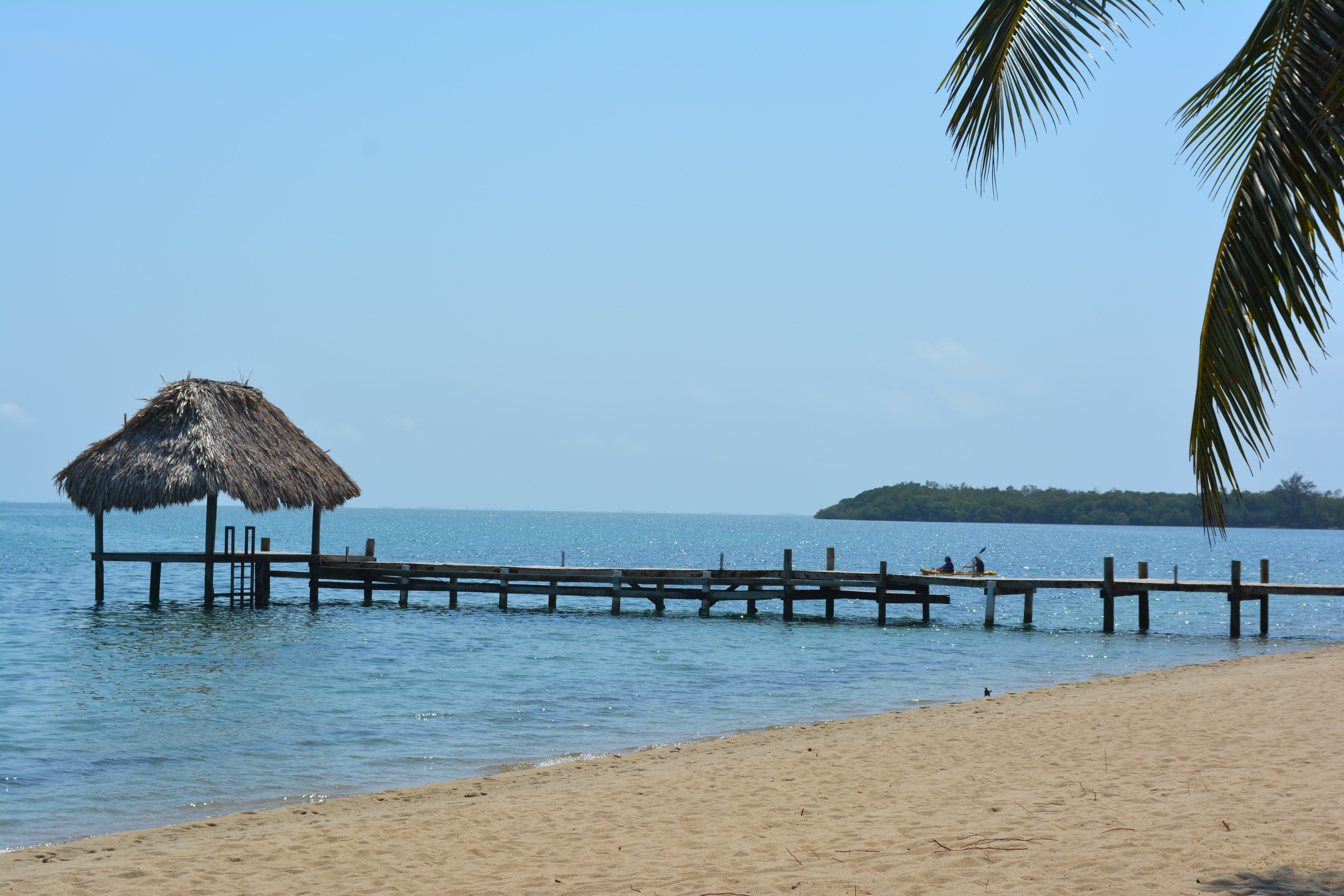
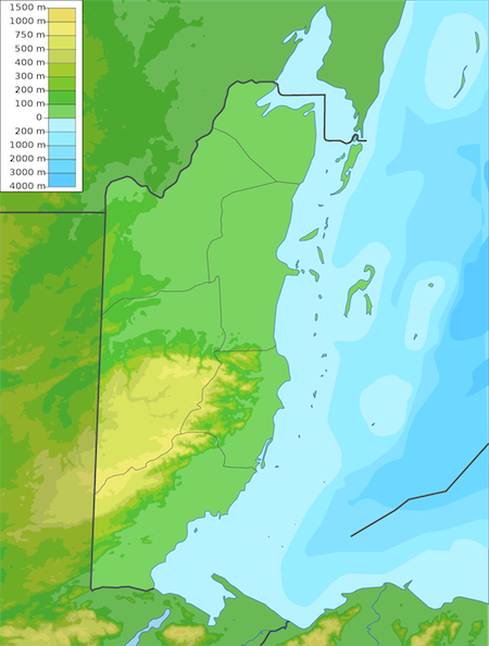
Geography of Belize : Belize is located on the Caribbean coast of northern Central America.
Geography of Belize
Geography of Belize is such that it shares a border on the north with the Mexican state of Quintana Roo, on the west with the Guatemalan department of Petén, and on the south with the Guatemalan department of Izabal. To the east in the Caribbean Sea, the second-longest barrier reef in the world flanks much of the 386 kilometers of predominantly marshy coastline. The area of the country totals 22,960 square kilometers, an area slightly larger than El Salvador or Massachusetts. The abundance of lagoons along the coasts and in the northern interior reduces the actual land area to 21,400 square kilometers.
Belize is shaped like a rectangle that extends about 280 kilometers north-south and about 100 kilometers east-west, with a total land boundary length of 516 kilometers. The undulating courses of two rivers, the Hondo and the Sarstoon, define much of the course of the country’s northern and southern boundaries. The western border follows no natural features and runs north-south through lowland forest and highland plateau. The north of Belize consists mostly of flat, swampy coastal plains, in places heavily forested. The flora is highly diverse considering the small geographical area. The south contains the low mountain range of the Maya Mountains. The highest point in Belize is Doyle’s Delight at 3,688 ft (1,124 m.).
The Caribbean coast is lined with a coral reef and some 450 islets and islands known locally as Cayes (pronounced “keys”). They total about 690 square kilometers, and form the approximately 200 mile (322 km) long Belize Barrier Reef, the longest in the Western Hemisphere and the second longest in the world after the Great Barrier Reef. Three of the four coral atolls in the Western Hemisphere are also located off the coast of Belize.
Rainfall Levels

Total Rainfall for Belize by Stations in mm – Source : http://www.hydromet.gov.bz/yearly-weather-summary
Average rainfall varies considerably, ranging from 1,350 millimeters in the north and west to over 4,500 millimeters in the extreme south. Seasonal differences in rainfall are greatest in the northern and central regions of the country where, between January and April or May, fewer than 100 millimeters of rain fall per month. The dry season is shorter in the south, normally only lasting from February to April. A shorter, less rainy period, known locally as the “little dry,” usually occurs in late July or August, after the initial onset of the rainy season.
Hurricanes
Hurricanes have played key–and devastating–roles in Belizean history. In 1931 an unnamed hurricane destroyed over two-thirds of the buildings in Belize City and killed more than 1,000 people. In 1955 Hurricane Janet leveled the northern town of Corozal. Only six years later, Hurricane Hattie struck the central coastal area of the country, with winds in excess of 300 kilometers per hour and four-meter storm tides. The devastation of Belize City for the second time in thirty years prompted the relocation of the capital some eighty kilometers inland to the planned city of Belmopan. Another hurricane to devastate Belize was Hurricane Greta, which caused more than US$25 million in damages along the southern coast in 1978.
The latest Hurricane hit Belize in 2010. Hurricane Richard was a damaging hurricane that affected areas of Central America in October 2010. It developed on October 20 from an area of low pressure that had stalled in the Caribbean Sea. The system moved to the southeast before turning to the west. The storm slowly organized, and the system intensified into a tropical storm. Initially, Richard only intensified slowly in an area of week steering currents. However, by October 23, wind shear diminished, and the storm intensified faster as it headed toward Belize. The next day, Richard intensified into hurricane status, and further into its peak intensity as a Category 2 hurricane, reaching maximum winds of 100 mph (150 km/h). The hurricane made its only landfall on Belize at peak intensity. Over land, Richard quickly weakened, and later degenerated into a remnant low on October 25.
Hurricane Richard caused an estimated $80 million (2010 USD) in damages in its path, much of which was in Belize.
Terrain
Most recent vegetation surveys, about sixty percent (60%) of Belize is forested, with only about twenty percent (20%) of the country’s land subject to human uses (such as agricultural land and human settlements). Savanna, scrubland and wetland constitute extensive parts of the land. As a result, Belize’s biodiversity is rich, both marine and terrestrial, with a host of flora and fauna. About thirty-seven percent (37%) of Belize’s land territory falls under some form of official protected status. Although a number of economically important minerals exist in Belize, none has been found in quantities large enough to warrant their mining. These minerals include dolomite, barite (source of barium), bauxite (source of aluminum), cassite (source of tin), and gold. In 1990 limestone, used in roadbuilding, was the only mineral resource being exploited for either domestic or export use.
Geology
The similarity of Belizean geology to that of oil-producing areas of Mexico and Guatemala prompted oil companies, principally from the United States, to explore for petroleum at both offshore and on-land sites in the early 1980s. Initial results were promising, but the pace of exploration slowed later in the decade, and production operations had been halted. As a result, Belize remains almost totally dependent on imported petroleum for its energy needs. In 2006, the cultivation of newly discovered Crude Oil in the town of Spanish Lookout, has presented new prospects and problems for this developing nation. The country also possess considerable potential for hydroelectric and other renewable energy resources, such as solar and biomass. In the mid-1980s, one Belizean businessman even proposed the construction of a wood-burning power station for the production of electricity, but the idea foundered in the wake of ecological concerns and economic constraints.
Elevation across Belize
Highest point in Belize is called Doyle’s Delight and the lowest points in Belize meet the coastlines of Belize then travel below the surface of the sea.
Victorias Peek (1120 meters) was thought to be the highest point in Belize until it was discovered that Doyle’s Delight is slightly higher in elevation at 1,124 m (3,688 ft). Victoria’s Peek in located east of the Maya Mountain Divide in the Stann Creek District. Doyle’s Delight is located in the heart of the Maya Mountains in the Cockscomb Range of Western Belize. Unlike Victoria’s Peek, which on a clear day can be seen for miles, Doyle’s Delight has no demonstrative point.
Sharon Matola, Founder of the Belize Zoo, was the first to use the name Doyle’s Delight in her 1989 report she wrote called “The Doyle’s Delight Expedition, Maya Mountains, Southern Belize”. Sharon is famous in Belize for her conservation efforts and her decades of service to Belize. You can read her story here in this book : The Last Flight of the Scarlet Macaw: One Woman’s Fight to Save the World’s Most Beautiful Bird by Bruce Barcott. Get the book here….
(Note: the Kindle version price will show once you click the link)


